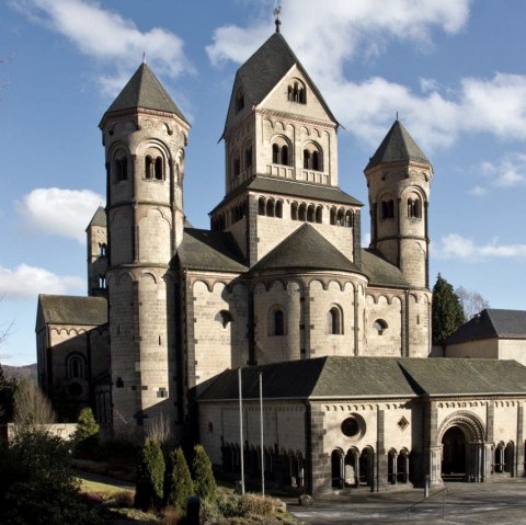
monreal, © Ursula Peters, Eifelverein e.V.
  • Distance: 116.9 km
  • Difficulty: medium

Osteifelweg - Gesamtverlauf

Mayen

The Osteifelweg (HWW 1) is divided into 8 daily stages, which can, however, be planned variably.

Stage 1: Bonn-Venusberg - Berkum (14.8 km)

Stage 2: Berkum - Bad Neuenahr (16.2 km)

Stage 3: Bad Neuenahr - Oberdürenbach (12.4 km)

Stage 4: Oberdürenbach - Maria-Lach Monastery (13.4 km)

Stage 5: Maria-Laach Monastery - Hammesmühle (13.2 km)

Stage 6: Hammesmühle - Monreal (11.7 km)

Stage 7: Monreal - Burg Pyrmont (20.7 km) ROUTE IS SIGNPOSED

Stage 8: Burg Pyrmont - Moselkern Bf (14.6 km)

The Osteifelweg markings: three-colored "E" (blue, brown, green) on a white background; above it "EIFELVEREIN", below it on a green field "Osteifelweg"

Source: Eifelverein e.V.

For more information, there is a great article from Deutschlandfunk about the Osteifelweg here !

mehr lesen

Marking of the tour:

  • Logo Osteifelweg, © Eifelverein e.V.
gpx: Osteifelweg - overall route

Share content:

Along the route

Bitte akzeptieren Sie den Einsatz aller Cookies, um den Inhalt dieser Seite sehen zu können.

Alle Cookies Freigeben

More information about this route

Distance: 116.9 km

Difficulty: medium

Ascent: 2,006 m

Descent: 2,115 m

Tipps zur Tour

Please download the gpx track and the map of the trail in advance, as the signposting may be patchy in some areas.

Please stay on marked paths.

Particularly in the fall, please note that leaves lying on the ground can hide bumps, roots, etc. on the path.

Further information on the route can also be found in the EifelPfadFinder of the Eifelverein.

Touristik-Büro Vordereifel

Kelberger Straße 26
56727 Mayen
Phone: 02651 800 995
Fax: 02651 800 920

write e-mail

Plan your journey

per Google Maps